Route Description
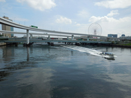
Kokusai-tenjijo Sta. →Panasonic Center Tokyo→Yume-no-Ohashi Bridge→Symbol Promenade Park→Tokyo Teleport Sta. (Exit A)
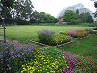
A healing space with greenery and water, consisted of promenades in three areas of the West, Center and East.
* These are estimates given for a person, weight 60kg, moving at 4km per hour, walking 10 min.=30kcal, one step=70cm.
(10.2MB)
*These courses are listed on P. 25 and 26 of the PDF Walking Map.
* Some details in the PDF walking map may differ from Google Map.
* Contact regarding the PDF walking map offered on this website.
[Koto City Public Health Center, Health Promotion Division TEL 03-3647-5889]