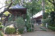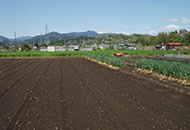
Route Description
Musashi-Masuko Sta.→Ajirobashi Bridge→Kishijima Jinja Shine→Mt. Bentenyama (summit)→Yamada-Ohashi Bridge→Musashi-Masuko Sta.
A course on which you climb Mt. Bentenyama. Be sure to do warm-up exercises and prepare for walking the mountain trail as it is quite energy-consuming.
* These are estimates given for a person, weight 60kg, moving at 4km per hour, walking 10 min.=30kcal, one step=70cm.
(1.22MB)
* Some details in the PDF walking map may differ from Google Map.
* Contact regarding the PDF walking map offered on this website.
[Health service section, Health and Welfare Department, Akiruno City TEL 042-558-1183]