
Route Description
Inagi Station→Entrance to the mountain trail→Spot where you can see Mt. Fuji and Komazawa Women’s University→Myokenji Temple and Myokenson Temple→Fukan Church→Tate-jinja Shrine→Inagi Station
This course is a little long and exceeds 9,000 steps, but the contrast between Satoyama and residential areas is enjoyable.
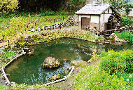
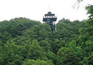
As soon as you step onto the mountain trail, a different world unfolds. After enjoying the nostalgic scenery, the course takes you to New Town, divided into sections.
The entrance to the mountain trail is slightly steep, but it does not continue long. Walk slowly if you do not like slopes.
* These are estimates given for a person, weight 60kg, moving at 4km per hour, walking 10 min.=30kcal, one step=70cm.
Besides, the time allowed is the actual time when we walked the course.
(1.25MB)
* Some details in the PDF walking map may differ from Google Map.
* Contact regarding the PDF walking map offered on this website.
[Inagi City Citizen Department Sports Promotion Section TEL 042-378-2111]